Wapiti Campground
Full SunJasper National Park · Alberta, Canada · 1070 m elevation · Check-in 2:00 PM · Check-out 11:00 AM
Year-round campground on the Athabasca River bank, 4 km from Jasper townsite.
Shade reality: The 2024 Jasper wildfire burned much of the surrounding forest — expect open, exposed sites and strong midday sun.
Individual sites · 364 mapped
Site positions come from Parks Canada open data (via OpenStreetMap); per-site shade ratings aren't published — use the sun rays and terrain shadows instead. Click any dot on the map for site details; zoom in to see site numbers.
Shadiest sites on 2026-08-02 (least direct sun)
Precomputed estimate for the 15th of this month — all 364 sites, terrain + tree canopy (ETH 10 m, 2020) included.
Find a site
Official campground map362 sites
Cross-check site numbers against the park's own map before you book.
Loops AA and A–F are unserviced; loop FF (northeast, closest to the river) has electrical sites. Registration is at the southeast entrance off Icefields Parkway (Hwy 93); the Athabasca River runs along the east side.
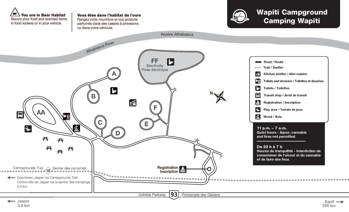
Source: official park map. Compare the loop layout with the satellite view above — north on the official map may not point up.